
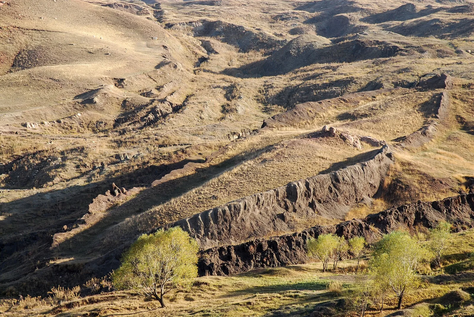
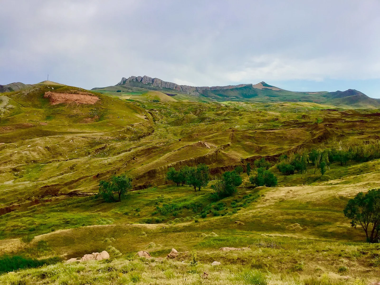
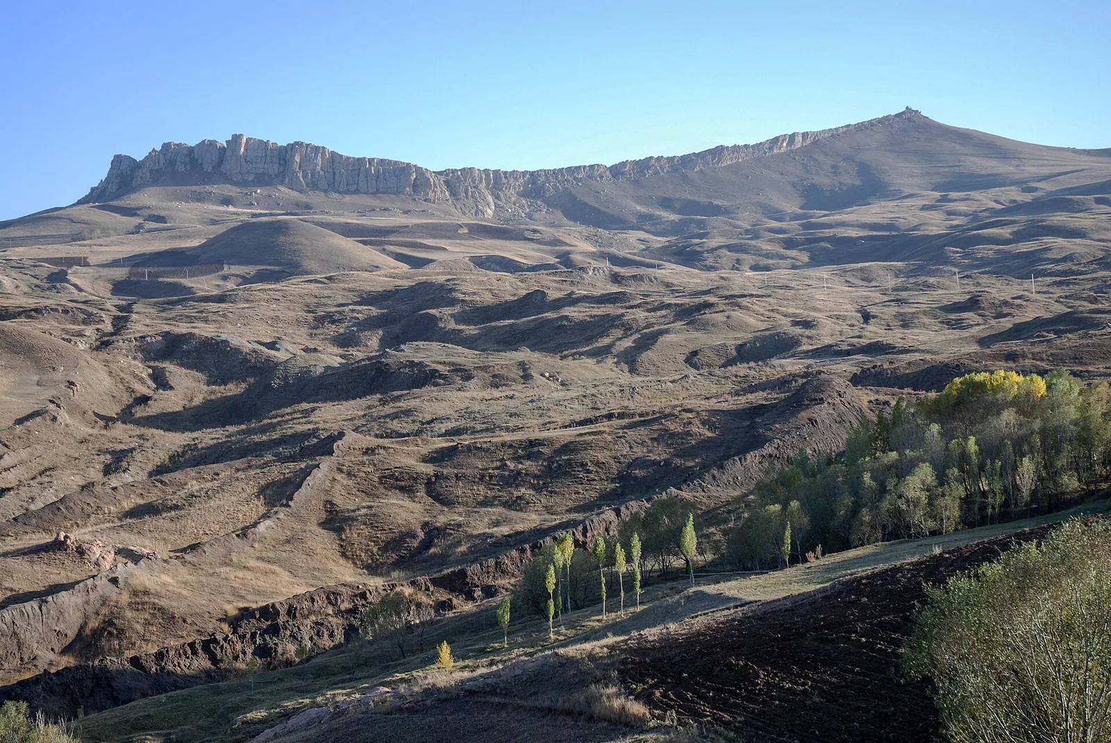
The Durupınar formation, October 2009. Photo: Zorka Sojka · CC BY-SA 4.0 · Wikimedia Commons
The Ararat File
The Possible Discovery of Noah’s Ark — Live Tracking
There is no A-level source confirming an artificial origin.
- DF status
- Announced / Under debate
- Next milestone
- 164 days approx.Laboratory results (C-14 and soils) from the 2026 season. Estimated date: “around May 2027”, according to the team.
- Researched up to
- November 14, 2026 C-14 from a French laboratory, announced in mid-October 2026 for “about 15 days”. Not published to date.
In one line
There is no verified, peer-reviewed evidence that the Durupınar formation is the Ark. Published geology explains it as a natural structure. The 2026 season recovered wood, some of it charred, which is being analysed.
Summary
In 1959, a Turkish army captain spotted a boat-shaped outline near Mount Ararat in aerial photographs. Since then, the Durupınar formation has repeatedly been presented as Noah’s Ark. In 2026, a team from Sivas Cumhuriyet University and the U.S. group Noah’s Ark Scans drilled the site, scanned it with radar and recovered wood, some of it charred, which is now being analysed.
The only peer-reviewed geological study devoted to the site (Collins and Fasold, 1996) explains it as a natural formation. Even the main creationist organizations reject it: Answers in Genesis, ICR and CMI.
This file separates what is proven from what is claimed, and it is updated as new data appear. Faith in the Genesis account does not depend on this find. It does depend on not claiming more than the evidence allows.
Site record
- Case
- Durupınar formation (“Noah’s Ark trace”, Nuh’un Gemisi İzi)
- Location
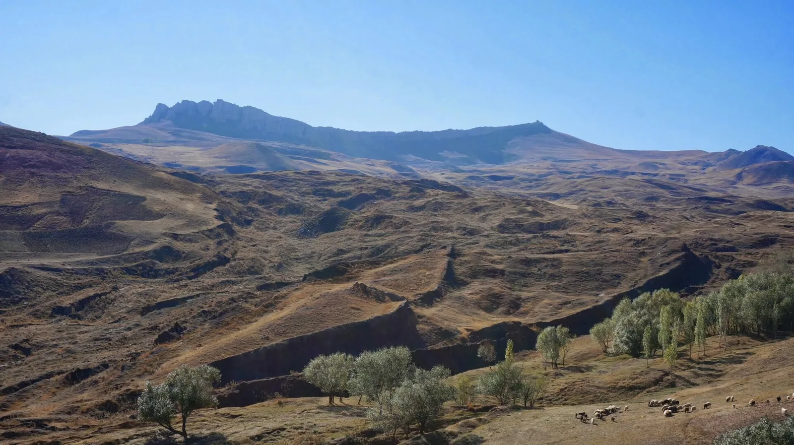
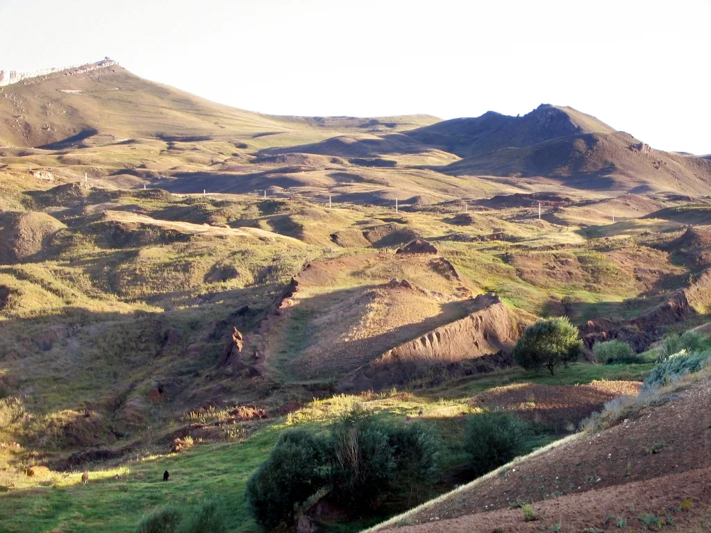
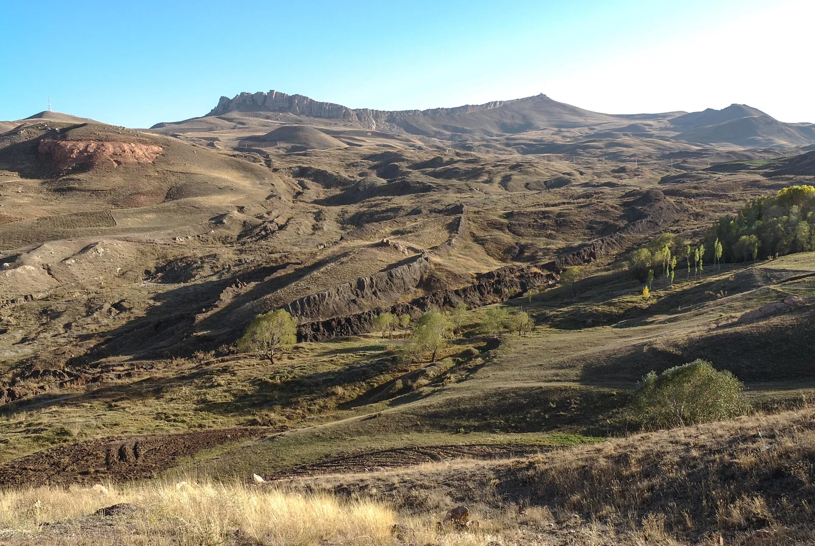
- Between Telçeker and Üzengili, Doğubayazıt (Ağrı, Türkiye). Slope of the Tendürek volcano, ~2,000 m altitude, ~29–30 km south of the summit of Ağrı Dağı (Mount Ararat).
- Size
- About 157–164 m long, boat-shaped (reported figures).
- Identified
- 1959, in aerial photographs from a mapping mission; Captain İlhan Durupınar.
- Legal status
- “Natural site and open-air museum”, decision no. 3657 of 17 Sep 1987. The Ministry of Culture calls it a “natural monument” and says its origin is still debated.
- Setting
- Valley on the slope of a volcano (last eruption, 1840). Active landslide zone.
- 2026 project
- Led by Prof. Cenker Atila (Archaeology, Sivas Cumhuriyet Univ.), with Noah’s Ark Scans (Andrew Jones). Permit: 21 May 2026. Fieldwork: 29 Jun → 11 Sep 2026.
The site
The Durupınar formation and its valley, on the slope of the Tendürek volcano.
Live radar
Automatic monitoring of sources in English, Spanish and Turkish. What appears here is unverified until it enters the file.
- Checking sources…
Claims vs. verified
Who claims what, with which source, at what level and in what state.
- 01AConfirmed
The formation exists, is about 157–164 m long and boat-shaped.
- 02APublished and debated
The formation is a natural geological structure (landslide or fold).
- 03RadarAnnounced
Radar shows corridors, chambers and right angles on “three levels”.
- 04RadarAnnounced
There is more organic carbon and potassium inside the formation.
- 05BAnnounced
Pottery and charred wood were found at about 9 m.
- 06BAnnounced
The wood is “very old”.
- 07BAnnounced
It was declared a “national park” on 20 Jun 1987.
- 08CAnnounced
The Hagopian testimony (c. 1900–1908).
- 09ARuled out
“Türkiye officially declared it to be the Ark in 1987.”
- 10BRuled out
“The Ark was dated to 5,000 years.”
- 11ARuled out
Rivets, stone anchors and petrified wooden ribs.
- 12✗Ruled out
“100% confirmed: a man-made object.”
- 13BRuled out
Viral “Ark found” video.
- 14BRuled out
Navarra’s wood (Ararat, 1955) is wood from the Ark.
- 15BRuled out
NAMI 2010 find on Ararat.
- 16BRuled out
The “Ararat anomaly” is the Ark.
Evidence by type
Radar (GPR / ERT)
20% of data analysed (Oct 2026)
What is reported
Linear reflectors, regular edges, a possible central “gallery” and structures down to ~6 m (NAS). Atila: “a corridor… maybe a geological hole”.
Critical reading
In ground with landslides, fractures and strata, linear reflectors have well-known natural explanations. As early as 1987 it was noted they could be wet cracks or clay fills.
Core drilling
16 holes / down to 18–20 m
What is reported
According to Rudaw, 16 holes (12 inside, 4 outside) down to 20 m. According to Jones, one point reached 18 m and the rest 5–8 m.
Critical reading
The figures do not match. We show both until the university publishes the data.
Soils
366 sent · “about 1,000” in total
What is reported
The university reports 366 samples sent to Ankara Yıldırım Beyazıt University; the governor spoke of ~360 and the team of “about 1,000”.
Critical reading
Most likely: ~360 already sent to the lab and ~1,000 as the total goal. Unresolved discrepancy.
Wood
~9 m · 4 labs
What is reported
Charred and uncharred fragments with visible rings, sent to 4 laboratories in 4 countries. New surface fragments after the rains (10 Nov).
Critical reading
They have not been independently linked to the Ark. The team itself says it will not know until results arrive.
2022–2023 dating (ITU)
~30 samples · 3,500–5,000 years
What is reported
Rock and soil samples indicating regional human activity in the Chalcolithic.
Critical reading
They do not date a boat. The marine remains they contain are common in Anatolian geology.
Timeline
3rd c. BC – 1st c. AD
Berossus, quoted by Josephus, places remains of the vessel in the region of the Gordyaeans (Corduene).
1955 / 1969
Fernand Navarra recovers wood from the Ararat glacier; C-14 dates it to AD 260–790.
1959
Captain İlhan Durupınar identifies the outline in aerial photographs.
Sep 1960
First expedition to the site: finds only soil and rocks.
1977 →
Ron Wyatt promotes the site (“rivets”, “anchors”, “ribs”).
17 Sep 1987
Decision no. 3657: natural site and open-air museum.
Sep 1996
Collins and Fasold publish that it is a “common geologic structure”. Fasold, a former promoter, co-signs the retraction.
2010
NAMI case (Hong Kong): announces the Ark on Ararat “99.9%”; later, a report of probable fraud. Unrelated to Durupınar.
2014, 2019 →
GPR/ERT scans by Noah’s Ark Scans.
Dec 2022
About 30 samples analysed at ITU indicate regional human activity (5500–3000 BC). They do not date a boat.
Jun 2025
Eşref Atabey: a geological structure formed by a landslide.
21 May 2026
Permit from the Erzurum Regional Commission for the Protection of Natural Assets.
29 Jun → 11 Sep 2026
Field season: ~20 researchers from 5 countries; GPS, 2D/3D, GPR, ERT and core drilling.
26 Sep 2026
AA news agency fact-check: no confirmed wood, nails or human material; nothing peer-reviewed.
27 Sep 2026
Atila: “100% proven” headlines are misleading.
2 Oct 2026
The governor of Ağrı: “there is no scientific certainty for now”.
8 Oct 2026
AA debunks a viral “Ark found” video: AI-generated.
15 Oct 2026
Atila announces burnt wood sent for C-14 and admits the structures “could be geological formations”.
10 Nov 2026
NAS presents charred and uncharred wood from about 9 m, sent to 4 laboratories in 4 countries.
13 Nov 2026
No laboratory results have been published yet.
~May 2027
Full laboratory results expected.
The geological objection
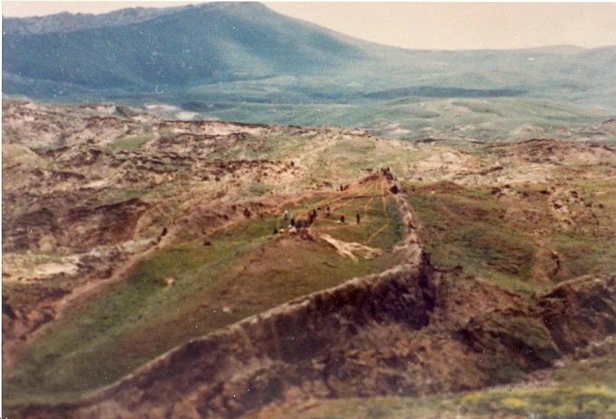
- Collins and Fasold (1996): the shape is explained by folding, erosion, mudflows and landslides. No fossil wood or elemental carbon was found. The “anchors” are local volcanic rock; the “compartments”, mineral concentrations and natural fractures.
- Collins (2013, 2016) corrects the mechanism —it is not a doubly plunging syncline— but keeps the natural origin.
- Atabey (2025): the formation lies in a landslide zone and is in continuous movement.
- Snelling (AiG): a limestone block sliding over clays. For a creationist geologist, the surrounding volcanic rocks would post-date the Flood.
The critique from faith
- Answers in Genesis rejects it (2025 and 2026). Snelling adds a textual argument from Gen 8:4–5: the ark comes to rest and the mountaintops are seen only 74 days later, which does not fit a valley floor.
- ICR: John Morris visited the site twice and concluded it has a simple geological explanation. In 2020, ICR acknowledged the Ark has not been found.
- CMI investigated the NAMI fraud on site. Apologetics Press, Premier Christianity, Gordon Franz and Jeremiah Johnston also reject it.
- Shared argument: Noah likely reused the timber, and faith in God’s Word does not rest on finding the Ark.
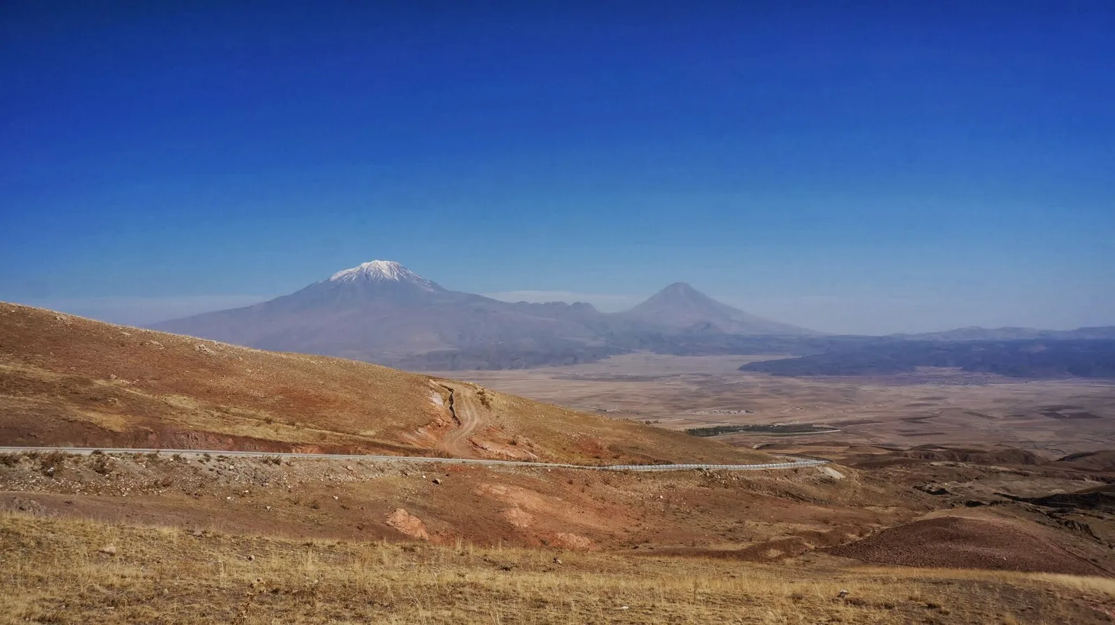
What Scripture says
«and in the seventh month, on the seventeenth day of the month, the ark came to rest on the mountains of Ararat.»
Genesis 8:4 (ESV)
«And the waters continued to abate until the tenth month; in the tenth month, on the first day of the month, the tops of the mountains were seen.»
Genesis 8:5 (ESV)
“Mountains”, plural. Ararat corresponds to Urartu, the kingdom centred on Lake Van between the 9th and 6th centuries BC: a region, not a peak.
Ancient traditions: Berossus and Josephus speak of the region of the Gordyaeans; the Targums and the Peshitta render “Qardu”. The Mount Cudi tradition, near Cizre, is older than the Ağrı Dağı one.
The biblical text does not require looking for the Ark on a particular peak, and the coherence of the account does not depend on a find.
Three myths this file corrects
Myth
“Türkiye officially declared it is the Ark.”
Reality
False. In 1987 it was protected as a natural site (decision 3657).
Myth
“It was dated to 5,000 years.”
Reality
That date refers to human activity in the region, not to a boat. The university itself clarified it.
Myth
“It is 100% confirmed.”
Reality
Denied by the scientific director, Cenker Atila. The fact-checker Doğruluk Payı rated it “partly false”.
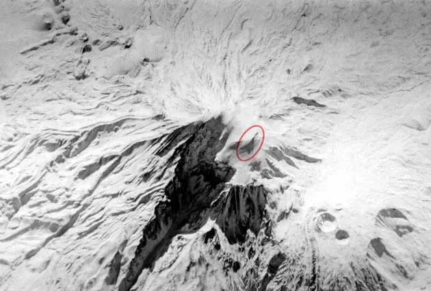
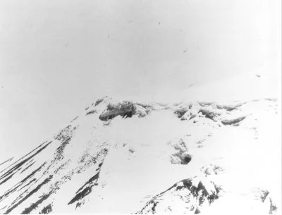
From the archive: the “Ararat anomaly”
Criteria to change the seal
The seal changes only by fixed rules, never by opinion.
0 of 5 met
- Published laboratory reports with species identification and calibrated C-14.
- Agreement among several independent laboratories.
- Documented stratigraphic context that rules out intrusion by landslide.
- Evidence of carpentry: joints, tool marks.
- Publication in a peer-reviewed archaeological or geological journal (A source).
An old date alone does not change the seal. If the results confirm a natural origin or recent or intrusive wood, the status becomes Ruled out.
Source scale
- A Admissible
- Peer review, official bodies, excavation reports, museum catalogues.
- B Context
- News agencies, fact-checkers and serious media. Checked against the A source they cite.
- C Framework
- Reference works, popular science and confessional sources with a declared bias.
- Radar Lead
- Promoters with a direct stake, tabloids, social media. Never enough to change the seal.
How this file works
Two layers: the radar reads sources automatically and marks everything as unverified; the file only includes entries checked against their source under the ESTRATO rules. Changes to the seal are decided by the DEFENSIO FIDEI editor.
Main sources
- A Collins, L. G. y Fasold, D. F. (1996). Bogus “Noah’s Ark” from Turkey Exposed as a Common Geologic Structure. Journal of Geoscience Education, 44(4), 439-444.
- A Dirección Provincial de Cultura y Turismo de Ağrı. Nuh’un Gemisi İzi (decisión 3657, 1987).
- A Universidad Sivas Cumhuriyet. Proyecto Durupınar 2026 (no es independiente del proyecto).
- A Atabey, E. (2025). Nuh’un Gemisi, heyelan etkisiyle oluşmuş jeolojik bir yapı.
- B Anadolu Ajansı – Teyit Hattı (26-sep-2026).
- B AA Teyit Hattı (08-oct-2026). Video generado con IA.
- B Doğruluk Payı (2026). Verificación.
- B The Conversation / Phys.org (oct-2026).
- B National Geographic (act. 2025). Where is Noah’s Ark?
- B NTV (27-sep-2026). Declaraciones de Cenker Atila.
- B Fox News Digital (10-nov-2026). Madera carbonizada (basada en material del promotor).
- C Answers Research Journal (2026). Reassessing the Durupinar Formation.
- C Snelling, A. (1992). Amazing “Ark” Exposé. AiG.
- C Apologetics Press. The Durupinar “Ark”.
- Radar Noah’s Ark Scans (parte interesada).
Image credits
- Turecko Noemova archa (03).jpg — Zorka Sojka · CC BY-SA 4.0
- 04400 Üzengili-Doğubayazıt-Ağrı, Turkey - panoramio (3).jpg — Ben Bender · CC BY-SA 3.0
- The Structure Claimed to be the Noah's Ark near the Mount Ararat in Turkey.jpg — Mfikretyilmaz · CC BY 3.0
- Turecko Noemova archa (02).jpg — Zorka Sojka · CC BY-SA 4.0
- The Durupinar site in July 2019.jpg — Wikkiwooki · CC BY-SA 4.0
- Turecko Noemova archa (04).jpg — Zorka Sojka · CC BY-SA 4.0
- Ark structure.jpg — Rudolf Pohl · CC BY-SA 3.0
- 04400 Üzengili-Doğubayazıt-Ağrı, Turkey - panoramio.jpg — Ben Bender · CC BY-SA 3.0
- Ararat anomaly 1973.jpg — CIA / Porcher Taylor · Dominio público
- Ararat anomaly 1949.jpeg — Fuerza Aérea de EE. UU. · Dominio público
Follow this file · DF · EXPEDIENTE 001 · ARARAT
Stay up to date, in real time
Get an email whenever there is news about this case. No noise: only what changes the picture.
- 01Seal changeIf the status of the case changes, you will know first, with the reasons.
- 02Verified updatesEvery new entry in the file, checked against its source.
- 03Laboratory resultsWhen the C-14 and soil results come out, with our reading of them.
This content is free
Keep it free for the Hispanic church
Every file, timeline, map and report on this site is free and open. It takes hours of research, sources and verification. If it serves you, help us keep it that way: from one dollar.
Be a blessing.
We are setting up the payment methods. Very soon you will be able to give from here.
Other ways to help →